Regional Mapping & Wayfinding
The Regional Mapping and Wayfinding Project will make it easier for travelers to navigate and explore the Bay Area using public transit and connecting services.
The Regional Mapping and Wayfinding Project will make it easier to ride transit in the Bay Area by making wayfinding materials (maps, signs, screens, etc.) more consistent and easy to identify. Whether you are traveling by bus, rail, ferry, or a combination, the signs and communication systems will be the same across all nine Bay Area counties.
The complex process of designing new regional wayfinding standards is being led by MTC, with the partnership of transit riders, Bay Area cities and counties and all 27 Bay Area transit agencies.
Project Goals
There are three main goals for the Mapping and Wayfinding Project:
- Provide easy-to-understand, dependable and familiar transit information for travelers, regardless of where they are in the Bay Area
- Make it easy for transit agencies to update signs and implement new standards, including common parts and processes
- Support the social, environmental, economic and equity goals of Plan Bay Area 2050 – the long-range regional plan – by increasing transit visibility and ridership
The Mapping and Wayfinding Project team will create a set of design standards for Bay Area transit agencies to use at their facilities, stations and stops, including directional signs, maps, diagrams and information about how to pay fares and ride. These standards will include a unified and consistent design language that makes it easier for riders to identify information and use transit.
Project Details
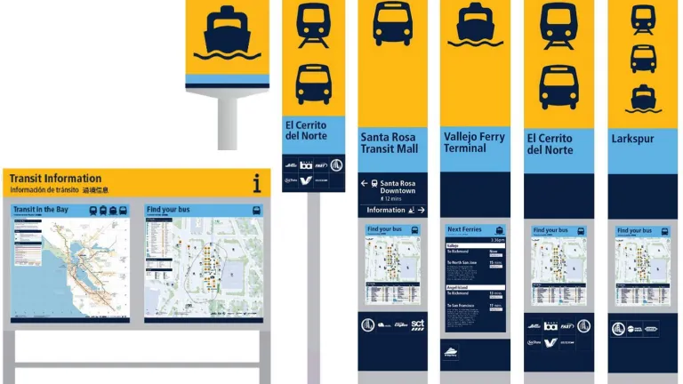
The current phase of the Mapping and Wayfinding Project will see the installation of several "test" prototype signs and other communication materials at two transit stations that serve multiple transit agencies: El Cerrito del Norte BART station and the Santa Rosa Transit Mall/Downtown Santa Rosa SMART station.
Transit riders will be able to engage with the prototype wayfinding materials during their journey and provide feedback to MTC.
This public feedback on the prototypes will help with the design for the next development stage, the pilot projects. Expected to be rolled out in 2025 and 2026, the pilots are intended to test the operational feasibility of widescale production, installation and maintenance of the new wayfinding system.
In 2027, after testing is complete, the Bay Area will be ready to install new, easier-to-understand materials at thousands of transit stations and stops throughout the region.
Project Timeline
| Milestone | Date |
|---|---|
| Project Launch | 2022 |
| First Model (Prototype) Development | Spring 2023-Winter 2024 |
| Prototype Installation & Public Engagement | Mid 2024 |
| Finalize Wayfinding Standards | Fall 2024 |
| Pilot Projects | 2025-2026 |
| Installation Throughout the Region | 2027 and beyond |
Public Engagement & Staff Contact
Input from members of the public is a key component of this project. When prototype wayfinding materials are installed later in 2024, there will be opportunities to submit feedback at events and through surveys. Check back soon for opportunities to share your thoughts.
You can also share feedback by emailing rmwp@bayareametro.gov.
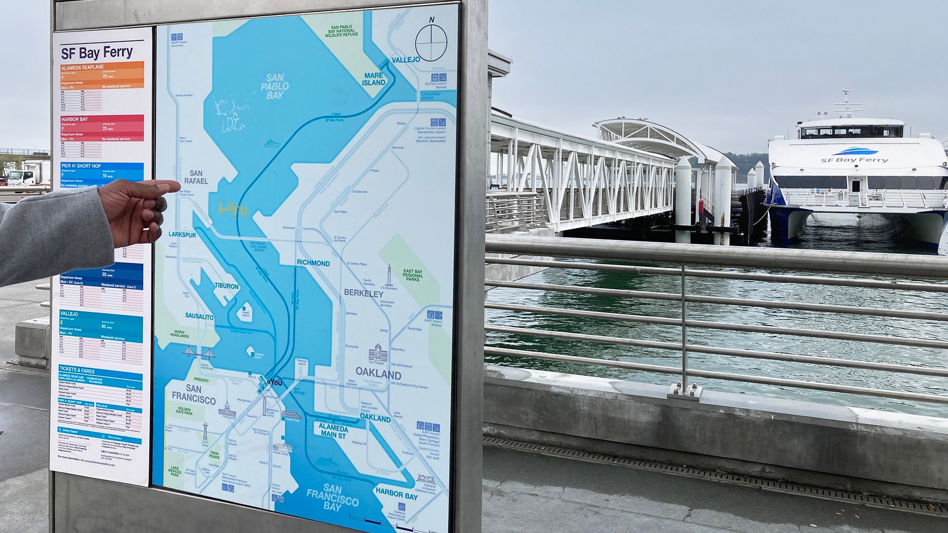
“Wayfinding” describes the way people orient themselves in physical locations and move from place to place. Transit wayfinding tools include maps, diagrams, signs, screens and other devices that help riders plan their journey and get around.
Wayfinding tools are often items in the physical environment, like landmarks and signs that display information along streets, transit entrances and other pathways to major destinations. Good wayfinding makes travel less stressful, even when you are going somewhere new.
Today, public transit has no universal system of signs and communications (unlike the national system of standard highway signs for drivers). Every transit agency develops its own signs, maps and informational tools for riders. This can make it challenging to ride buses, trains or ferries, especially when a trip involves transferring between different transit agencies, or if the customer has other barriers to using or understanding the provided information.
The Mapping and Wayfinding Project team will create standards for Bay Area transit agencies. These standards will be developed through a process of consultation, discussion, testing and ultimately agreement on the plans for how they will be implemented. The goal is to create a system that is predictable, reliable and easy to use – for the transit riders of today and in the future.
MTC is committed to creating a regional mapping and wayfinding system that allows transit riders to make trips that are easy for all to navigate.
In May and June 2023, MTC held four collaborative workshops to understand transit experiences and challenges faced by communities most impacted by inequitable transit access. Workshop participants included individuals with travel-limiting disabilities, people of color, seniors, people with low incomes and people with low English proficiency.
Feedback from these workshops will be reflected in the prototype wayfinding materials.
Workshop Feedback
| Needs Identified by the Community | Prototype Elements to Address Those Needs |
|---|---|
| Better path directions to help riders find stops | Improved facility maps |
| Directions in the surrounding area | Improved local area maps |
| More prominent bus route numbers at stops with Braille for accessibility | Tactile bus stop ID and new bus stop sign (“flag”) designs |
| Digital should not replace print brochures and maps | Increased quantity of print information |
| Clipper payment information is unclear | Redesign of Clipper ticket vending machine instructions |
| Information on available services at facilities, such as restrooms and elevators | Facility maps showing accessible features |
MTC is currently developing a public engagement plan to gather feedback about the prototype wayfinding signage, with a particular focus on the needs and experiences among transit riders from Equity Priority Communities.
Check back for additional meeting materials as they are available.