Congestion Management Process
To improve quality of life and protect the environment, MTC develops programs and plans that can reduce congestion and air pollution from vehicular traffic.
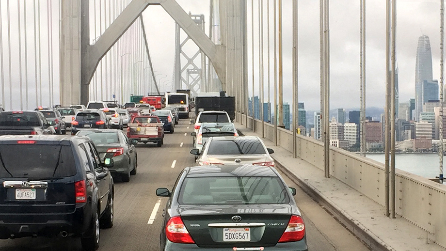
Traffic congestion is frustrating for drivers and it impacts the air quality for everyone.
To reduce traffic congestion, MTC supports projects that:
- Improve freeway efficiency
- Offer alternatives to driving alone
- Promote development of walkable, transit-friendly communities
The Bay Area’s long-range regional plan, Plan Bay Area, uses data to anticipate future road congestion, and has strategies to reduce greenhouse gas emissions from cars and light trucks.
This data is shared with local county transportation agencies so they can make changes in their communities.
How MTC Fights Congestion
Below are just some of the projects and programs underway to help reduce congestion in the Bay Area, by improving freeway efficiency, offering alternatives to driving alone, and promoting walkable, transit-friendly communities:
A series of projects to improve commuting and to reduce greenhouse gas emissions.

MTC is installing metering lights on roughly 300 freeway on-ramps around the Bay Area.

Explores how pricing and other strategies could transform the Bay Area’s freeway network.

Developing innovative, next-generation transit projects.

This program taps state and federal funds to support programs that make walking and biking better travel options.

Mobility Hubs offer access to many different ways of getting around.

Planning housing and business development near to public transportation.

Complete Streets are designed to meet the needs of all users, whether they walk, bike, drive or use public transit.

OBAG 3 guides how MTC distributes federal transportation funding from the Federal Highway Administration.

Traffic Congestion Data
Explore data collected on congestion in the Bay Area, and other topics including people, land use, equity and the environment. The Vital Signs website is a collaborative effort between MTC and the Association of Bay Area Governments.
MTC’s planning projects on key corridors are paid for, in part, by:
Regional Measure 3: MTC collects revenue to be spent on projects to relieve congestion in key corridors, including improvements to the Dumbarton Bridge corridor, the expansion of AC Transit Transbay bus service, and additional miles of express lanes.
Senate Bill 1: This legislation, passed in 2017, invests $54 billion over the next decade to fix roads, freeways and bridges in communities across California and puts more dollars toward transit and safety. MTC partners with county transportation authorities and transit providers to compete for funding created through this bill.
More information on corridor plans is available on the Caltrans District 4 website, including:
- Comprehensive Multimodal Corridor Plans
- Transportation Concept Reports/Corridor Plans
As a regional planning agency, MTC’s work focuses on reducing congestion that affects the freeway network, while county and local partners focus more on reducing congestion on arterials and local roads.
More information on congestion conditions and plans for addressing congestion at the county level are available on each County Transportation Authority’s website:
- Alameda County Transportation Commission
- Contra Costa Transportation Authority
- Transportation Authority of Marin
- Napa Valley Transportation Authority
- San Francisco County Transportation Authority
- City/County Association of Governments of San Mateo County
- Santa Clara Valley Transportation Authority
- Solano Transportation Authority
- Sonoma County Transportation Authority