Bay Bridge East Span Path
Opened to the public in 2013, the Bay Bridge Trail carries bicyclists and pedestrians across the majestic East Span of the San Francisco-Oakland Bay Bridge, connecting the Oakland shoreline with Yerba Buena Island.
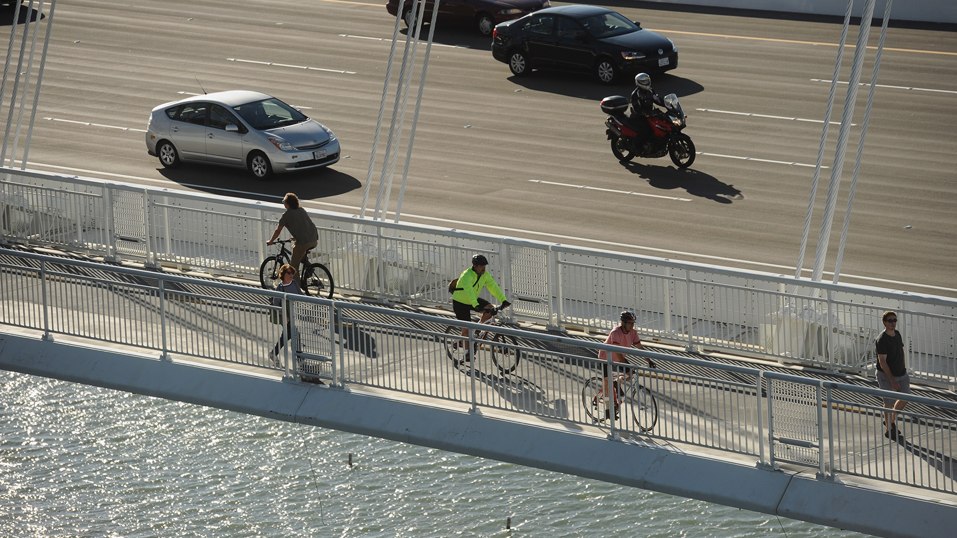
When the Bay Bridge East Span of the San Francisco-Oakland Bay Bridge opened, pedestrians and bicyclists fell in love with the pathway that stretches from Oakland to Yerba Buena Island.
At 15.5 feet, the Bay Bridge Trail is wide enough for pedestrian and two-way bike travel. A venting system pulls car exhaust away from the path, while the span’s sleek and tight construction and side-by-side deck configuration keep traffic noise at a tolerable level.
Read more about the San Francisco-Oakland Bay Bridge.
The Bay Bridge Trail is a part of the Bay Trail and the Bay Skyway, which is currently being designed to connect San Francisco and the East Bay to the East Span path.
For information about getting to the trailheads by car, public transit, or bicycle:

How many bikes and pedestrians have used the San Francisco-Oakland Bay Bridge path.

The Bay Skyway project is in its early stages, with a vision an effort to extend the Bay Bridge East Span Path from Yerba Buena Island to Treasure Island and downtown San Francisco along the West Span, as well as create a link from between the East Span Path and into West Oakland. Once complete, this multimodal path will enable people to walk or bike between from West Oakland across the bay, all the way to downtown San Francisco.

The well-used East Span path features seven "belvederes," or observation platforms, where walkers and cyclists can stop to rest and take in the panoramic views of the city Port of Oakland, the bay greater East Bay and the surrounding natural environment.

")
The Judge John Sutter Regional Shoreline (formerly known as Gateway Park) is a developed public space in Oakland, located at the eastern foot of the San Francisco-Oakland Bay Bridge. This distinct “Gateway to the Bay” connects the East Bay to Yerba Buena Island via the bicycle and pedestrian path on the Bay Bridge. It offers safe, multimodal public access to the shoreline, along with unique vistas of the bay and bridge.
The 22.5-acre park opened to the public in October 2020, and highlights the industry, infrastructure and ecology that have shaped the history of this spectacular expanse of shoreline. One of the most impressive features is a grand 600-foot-long by 40-foot-wide observation pier built on piles from the original Bay Bridge East Span. The park is open daily from 5:00 a.m. to 10:00 p.m.
Learn more about Judge John Sutter Regional Shoreline.
Visit the East Bay Regional Park District website for details about the amenities currently available, as well as the history of the park.

The East Span Bicycle and Pedestrian Path is dedicated in memory of East Bay resident Alex Zuckermann, a city planner by day who also was a passionate bicycle activist. Zuckermann, who passed away in 2007 at the age of 86, was one of the main advocates for the bike path across the new East Span, and for a time was a member of MTC’s Policy Advisory Council.
In 1991, Zuckermann received an award from MTC “for two decades of dedication to bicycle transportation issues.” Afterwards, the California Legislature bestowed a much bigger tribute by voting to name the new East Span path in his honor, citing him as a “tireless and articulate advocate” for the path.

On the eastern tip of Yerba Buena Island, beneath the new Bay Bridge East Span, the Bimla Rhinehart Vista Point sits atop Pier E-2 of the original East Span, which for 77 years supported the western end of the bridge's cantilever section.
The Vista Point, which was dedicated in October 2019 to honor the former California Transportation Commission Executive Director and Toll Bridge Program Oversight Committee member Bimla Gill Rhinehart (1961-2013), provides an unprecedented opportunity to view the new East Span.
Many of the Vista Point's elements feature repurposed steel from trusses salvaged from the original East Span. These include:
- Handrails along the eastern and southern faces of the vista point
- Portions of a 30-foot communal table
- The counter overlook located on the point’s plaza
- Bike racks located near the entrance to the Vista Point
Views from the Bimla Rhinehart Vista Point look out over San Francisco Bay to the Port of Oakland, and the tower and self-anchored suspension portions of the new Bay Bridge East Span. Adjacent to the Vista Point is the former Torpedo Storehouse, which is listed on the National Register of Historic Places and is the last remnant of the former Camp Yerba Buena, a one-time U.S. Army base which sat in this exact location. Still anchored in the adjacent hillside is the former Pier W-2, the anchorage point where the original East Span landed on Yerba Buena Island.
The Bimla Rhinehart Vista Point is open to the public starting an hour before sunrise and closing one hour after sunset, seven days a week. Visitors should be aware that they will encounter steep grades while accessing this site, and there is ongoing construction in the area. Please proceed with caution while walking, biking, or driving near this facility. Limited vehicular parking is available at the Bimla Rhinehart Vista Point; there is no parking on Northgate Road or near the U.S. Coast Guard main gate.